Effective river restoration and monitoring requires a detailed understanding of riverbed conditions and channel form. To support evidence-based planning and investment, the Restoring the upper Murrumbidgee River (RUMR) Program commissioned a bathymetric survey to map the depth, shape and key physical features of the upper Murrumbidgee River.
Specialist hydrographic surveyors SandMap surveyed approximately 200-kilometre bathymetric survey – mapping the depth, shape and physical features of the upper Murrumbidgee. Across the survey area, the river falls approximately 765 metres–from around 1,200 metres to 425 metres above sea level–and passes through steep gorges, extended rocky rapids and shallow, boulder-strewn reaches.
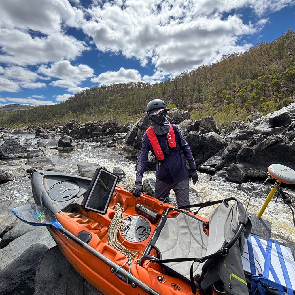
The challenging terrain prevented the use of conventional survey boats or remotely operated vessels. Kayaks were therefore used to collect data along the full survey route. One kayak was configured as a mobile survey platform and equipped with an echo sounder, high-precision Global Navigation Satellite System (GNSS) positioning and a satellite communications link. A second kayak carried supplies and safety equipment, while a third team member provided land-based support using a four-wheel-drive vehicle.
Collecting the data required significant field effort. The surveyors paddled navigable sections and manually moved or lowered the kayaks through rapids and other inaccessible reaches. In some locations, the team transported the kayaks across dense riverbed vegetation for several kilometres. Where river access was not possible, surveyors carried approximately 25 kilograms of equipment through steep, blackberry-covered terrain to reach the nearest road.
Fieldwork was completed over 38 days between November 2025 and February 2026.
Survey outputs
The project used a continuous single-beam survey undertaken in a zigzag pattern across the river channel. More detailed multibeam and sub-bottom mapping was also completed at four priority river pools.
The survey has produced accurate, contemporary mapping of river depth and channel form. This information enables the RUMR Program and its delivery partners to identify important river features, including:
- deep-water pools that provide refuge habitat for fish
- shallow riffles that support water oxygenation and aquatic habitat
- potential barriers to fish movement along the river.
How the data will be used
The survey provides an important evidence base for the broader RUMR Program. The mapping and associated data are supporting several related projects and will be used to:
- identify deep-pool refuges and priority fish habitat to inform water-quality monitoring
- select and prioritise sites for baseline and condition monitoring
- monitor in-stream habitat restoration works and assess changes in river depth over time
- identify potential sediment sources and measure sediment accumulation in priority pools
- update flow models and inform assessments of environmental water requirements for the Upper Murrumbidgee River.
By collecting this information through a coordinated survey, the RUMR Program has established a consistent dataset that can support scientific analysis, monitoring, restoration planning and on-ground delivery across multiple projects.
Delivered by: SandMap
Status: Completed in 2026
Location: Upper Murrumbidgee River, from Tantangara Dam to the ACT border, across New South Wales and the Australian Capital Territory
Explore the survey data: Upper Murrumbidgee River Bathymetric Project—river depths
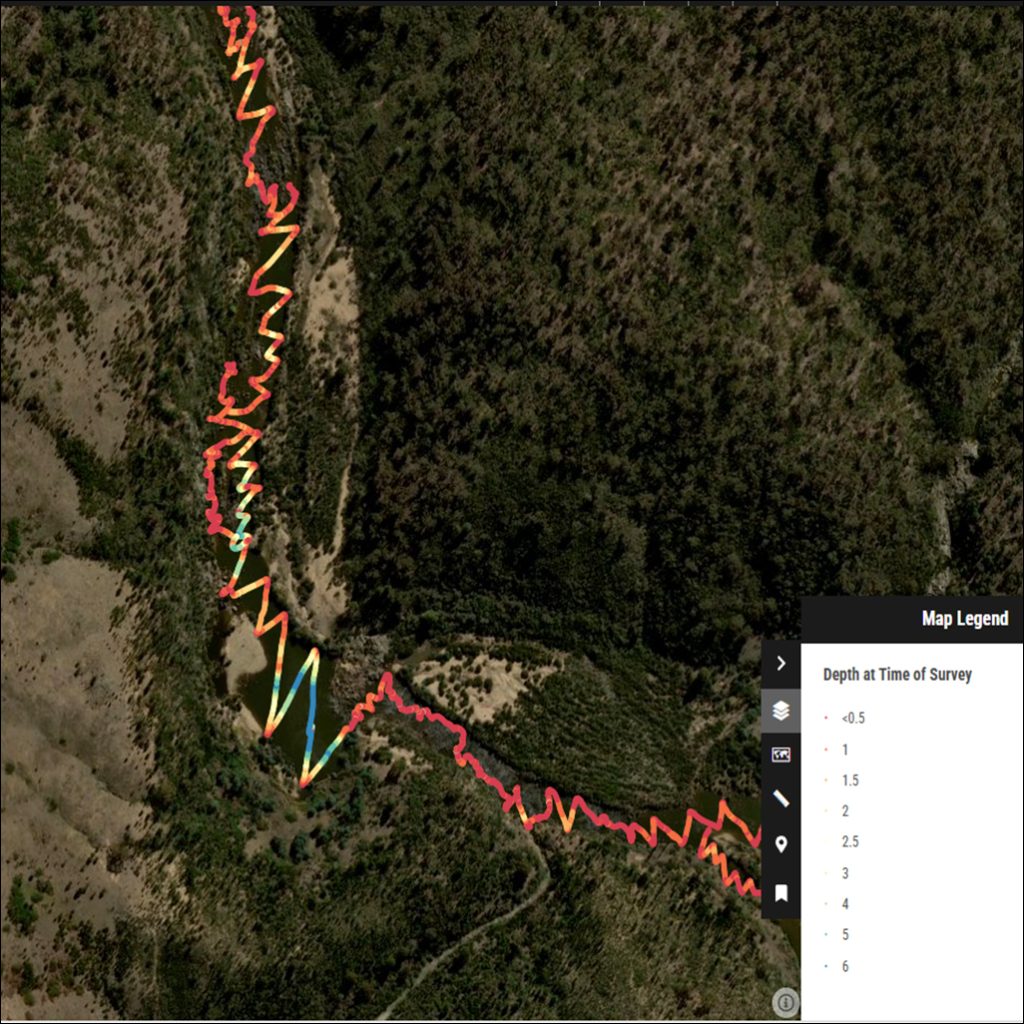
Showing an important refuge pool in Gigerline Gorge on the bidgee river in southern ACT